Our Volunteers Get "CABIN" Trained
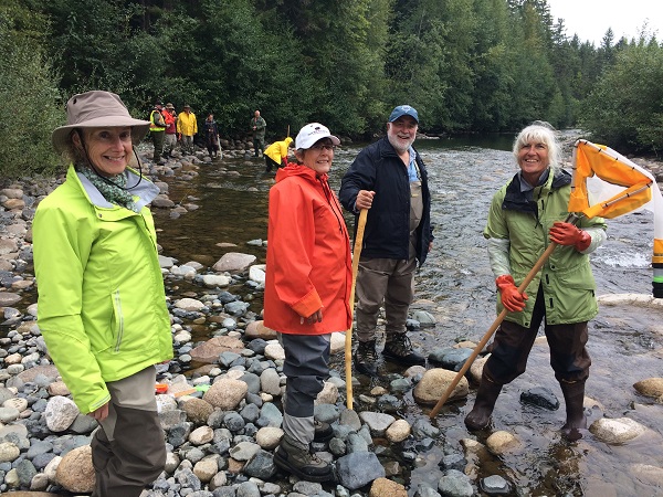
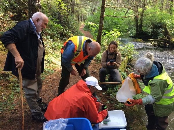
On September 9 and 10, volunteers from the Mid Vancouver Island Habitat Enhancement Society gathered at the Englishman River in Parksville for a training course in the collection of aquatic bugs using the Canadian Biological Monitoring Network (CABIN) method.
The bugs living at the bottom of our rivers and streams can tell us a lot about the health of those waterbodies. Some are found only in unpolluted waters while others dominate polluted environments. The CABIN monitoring program, led by Environment and Climate Change Canada, assesses the health of freshwater ecosystems like the Englishman River using bugs.
The course was taught by two intrepid instructors from Living Lakes Canada based out of Nelson, BC. Heather Leschied is in the foreground wearing the purple jacket, and Raegan Mallinson is holding the specially designed CABIN net used for collecting bugs. They did an awesome job training such a diverse group as ours!
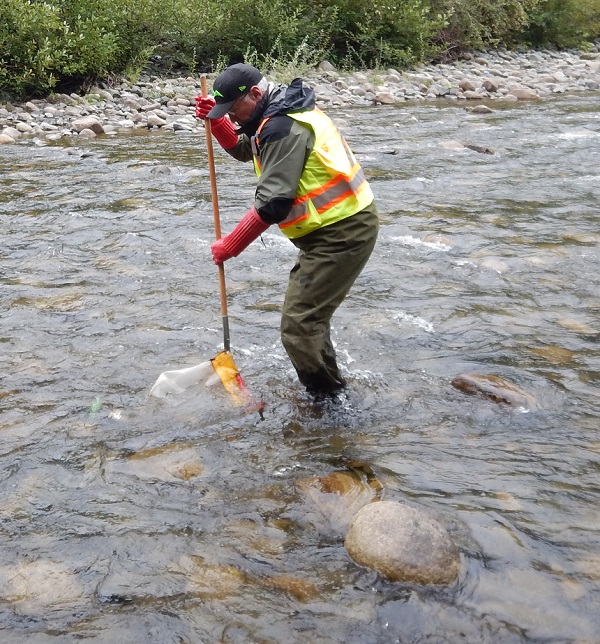
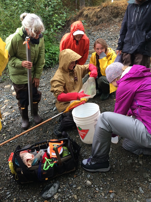
Samples are collected by holding the CABIN net against the bottom of the creek or river in a riffle area while the person holding the net vigorously kicks up the bottom for exactly three long minutes. The insects living at the bottom are stirred up and swept into the net by the current where they are funnelled into a plastic bottle screwed into the end of the net.
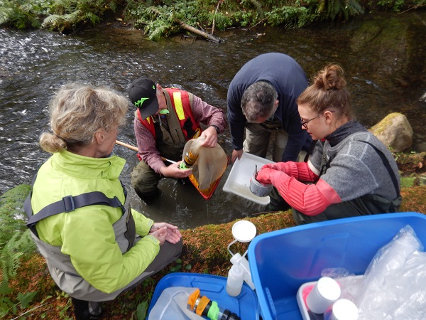
The plastic bottle is unscrewed from the net and the contents poured into a plastic sampling jar. The jar is sent to a scientitist called a Taxonomist who now has the job of counting and identifying the bugs down to the species level. How they do this without going bug-eyed (heh, heh), I don't know.
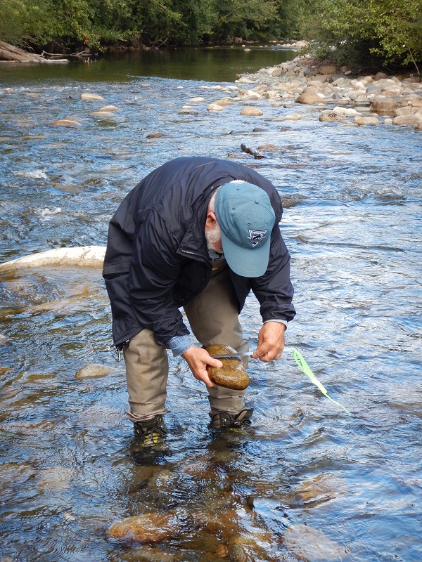
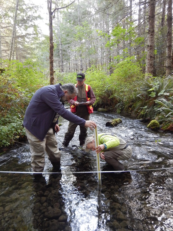
Additional data about the river is collected, such as water quality, flow velocity, slope, the type of bottom, and surrounding vegetation.
 Our volunteers have been trained and certified to a nationally acceptable standard. The beauty of this system is that monitoring data entered into the CABIN database from creeks and rivers across Canada have been collected using the same method, so the results from one waterbody can be compared with the results of others. The database contains reference creeks and rivers for each region of Canada that are used as examples of unaffected to severely affected ecosystems. For instance, data collected from the Englishman River would be compared with the data from reference rivers for the Vancouver Island Region to determine where it lies on the scale of being environmentally affected.
MVIHES plans on using this method to monitor the health of the Englishman River and tributaries such as Shelly Creek. When done periodically on a waterbody it could determine whether health is improving, declining or remaining the same over time. It would be wonderful to have scientific proof that the health of a creek is improving following stream remediation work or a change in water management.
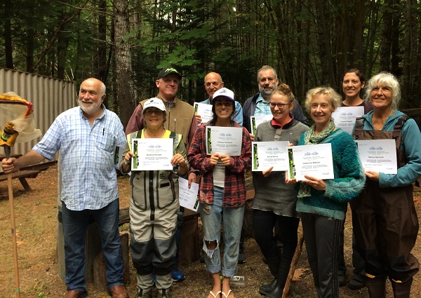
Congratulations CABIN Volunteers!

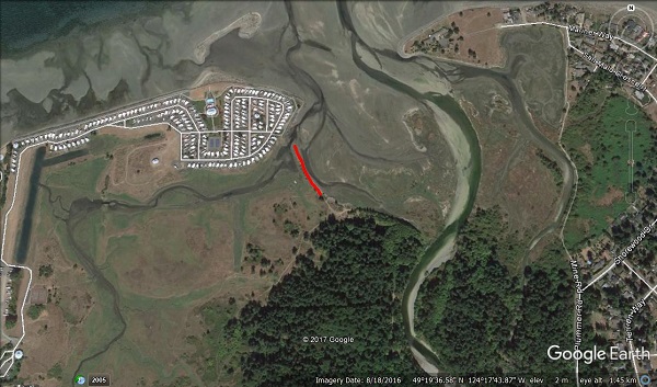


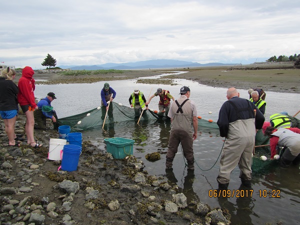 MVIHES is conducting a beach seining study this summer in the Englishman River Estuary as part of a project with the Nature Trust. Thanks to the Nature Trust, one of the man-made dykes in the estuary is being removed. Why you ask? That's a very good question.
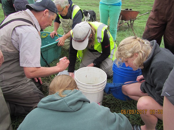 The Nature Trust plans to monitor the changes that occur in the western portion after the dyke is removed. That's where MVIHES and the Arrowsmith Naturalists come in. We are identifying and counting the fish that we capture during beach seining to determine if the numbers and species of fish change after removal of the dyke. The Arrowsmith Naturalists are monitoring vegetation in the western portion to determine what changes occur in the vegetation.
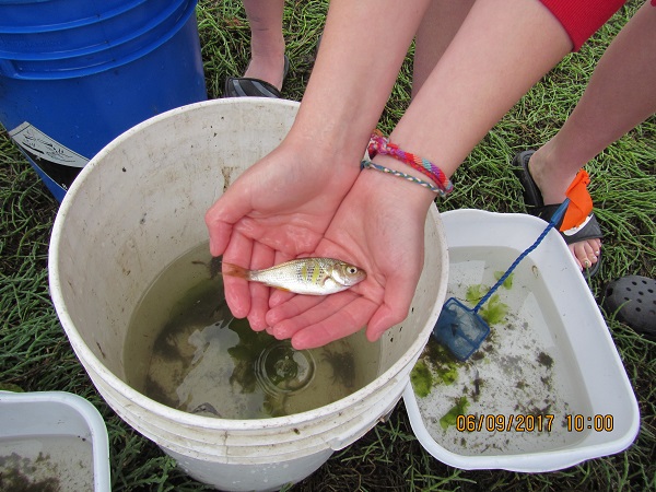 where beach seining occurred during the bio-inventory are being used in this year's study, so not only can we compare results from before and after the dyke is removed, we can also compare with the results in the bio-inventory.