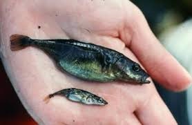
"Forage fish are small fish that travel in large schools and are a food source or 'forage' for larger fish and marine mammals. Forage fish, including Pacific herring, 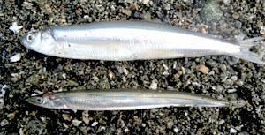 Pacific sand lance (seen in bottom of photo) and surf smelt (seen in top of photo) form the cornerstone of marine food webs. They, and other forage fish species play an important role in the diets of Humpback Whales, Porpoise, Sea Lions, Seals, Salmon and marine birds.
From sand grains to whales, it's all connected. Surf smelt and Pacific sand lance lay tiny eggs (1mm) on pebble and sand beaches just below the high-tide line - an area called the intertidal zone. The number and health of these beaches play an important role in the lives of the salmon, whales and marine birds that rely on each generation of forage fish for food." - Islands Trust Fund
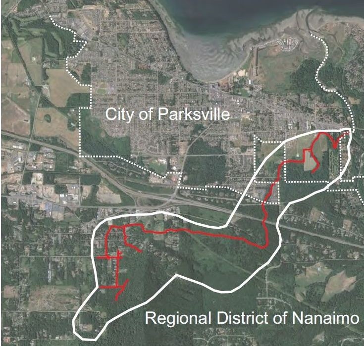
Our actions on and around these beaches, like shoreline development, can impact forage fish spawning habitat, so it is important to identify and map these areas. Since 2018, MVIHES has been identifying and sampling forage fish spawning habitat on the beaches from Craig Bay to Columbia Beach in French Creek so spawning habitat can be protected from disturbance during the spawning window.
It has been suggested the fish prefer full and new moons, when high tides are at the highest and providing maximum area for spawning. At low tide, MVIHES volunteers visit the beaches from Craig Bay to Columbia Beach to collect sand and gravel samples to see if they contain eggs.
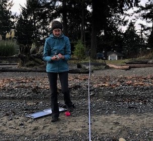
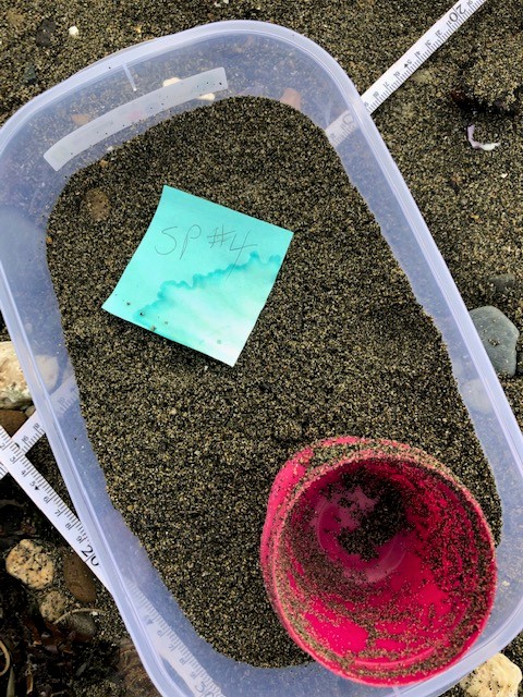
On November 10, 2020 MVIHES volunteers, collected habitat data and sand samples from 11 potential spawning sites. The sand samples, one of which is seen in the left-hand photo below, are sieved and "vortexed" to sort out the right sized sand grains where forage fish eggs and embryos can be found. The sorted sand from each site is placed in a sample bottle with a tag and checked under a microscope by VIU and MABBRI for the presence oMVIHES (Mid-Va...
f eggs and embryos. In December of 2018 and 2019, Pacific Sand Lance eggs were found in the sand samples from the beach in San Pareil.
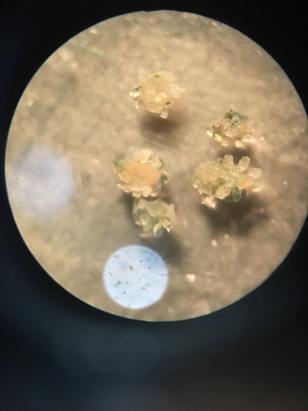
This time it appears Pacific Sand Lance eggs have been found on the beach in the Parksville Community Park. The photo to the right was taken through a microscope by MABRRI and shows five eggs attached to sand particles. The eggs were sent to an expert with the Dept. of Fish and Game in Washington State and verified to be Sand Lance.
In 2021 and 2022, Sand Lance eggs were found at Craig Bay, Parksville Community Beach, Rathtrevor Provincial Park, French Creek Marina, and San Pareil which continues to be the most productive area for spawning.
For more interesting facts about forage fish, read the article by MVIHES member Ross Peterson featured in PQB News.
In 2015, volunteers completed a survey on the upper section of Shelly Creek using the Urban Salmon Habitat Program (USHP) protocol . The results showed that much of the 2 km of creek above Hwy 19 has been excavated. This has resulted in significant changes to the natural hydrology of the watershed that have heavily impacted the lower section of Shelly Creek which supports a resident Cutthroat Trout population and overwintering Coho Salmon fry and smolts. These impacts became evident when the USHP conducted on the lower section of the creek in 2014 was compared with a USHP conducted in 1999. The comparison of USHP results for the the lower section of Shelly Creek shows there has been:
- significant increase in erosion of stream banks
- significant increase in the amount of fine sediment covering the bottom of pools
- 50% reduction in the number of pools (due to infilling by sediments)
- less cover for fish
- less gravel for spawning
- a high number of obstructions of fish passage during low flow
Without restoring the natural hydrology of the creek, any fish habitat restoration or mitigation we complete may not be successful. MVIHES retained Mr. Jim Dumont, a Hydrological Engineer, to conduct a water balance study that compares the current water flowpaths in the Shelly Creek watershed with pre-development flowpaths. From this study we hoped to find the root cause of the increased erosion and sedimentation, and methods for correcting the problem.
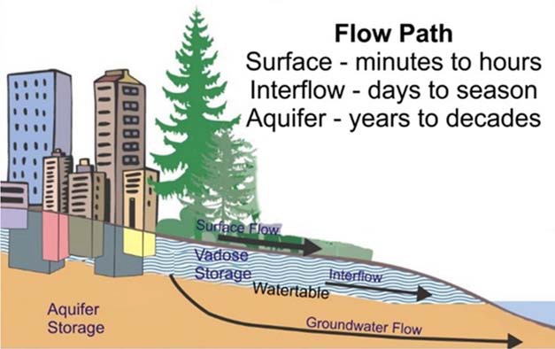
When we think of water flowing into creeks, we often think of surface flow that takes only minutes or hours to enter a creek, and groundwater flow that may take years to reach a creek. What we may not be aware of is interflow. When water sinks into the ground we often assume it is all going into the groundwater aquifers, however, much of it actually travels horizontally through shallow soil layers into the creeks. In fact, interflow is the primary pathway for water flow in an undeveloped watershed in coastal BC. It typically accounts for ¾ of the annual volume that reaches a stream. Interflow take days and perhaps a season to reach a creek and is important because it supplies water during dry spells.
Several things can and do interfere with interflow in the Shelly Creek Watershed and are associated with development. One is impervious surfaces such as buildings, pavement and concrete. These surfaces prevent precipitation from penetrating the soil to supply interflow. Most of the precipitation that falls on these surfaces becomes surface flow that enters and exits Shelly Creek over a short period of time, leaving the creek with almost no water during dry spells. Drainage ditches built along roads and in residential areas intercept interflow and turn it into surface flow which is directed into Shelly Creek. This increase in surface water flow during rain events is what is causing serious erosion and sedimentation problems. In fact, the water balance study shows the duration of flows that cause erosion (1 L/s/ha to 8 L/s/ha) has increased by more than a factor of 5 since pre-development. If development within the Shelly Creek Watershed continues in the same manner, the duration of erosion-causing flows is predicted to increase by 14-fold, a devastating outcome for Shelly Creek.
Why is development that impacts interflow to Shelly Creek happening?
Standard drainage engineering practice only considers surface runoff. The other two pathways (interflow and groundwater) by which rainfall reaches streams are ignored. In short, drainage engineering practice lags behind real-world hydrology, and as a consequence Shelly Creek is experiencing serious erosion and destruction of fish habitat.
An alternative to standard engineering practices is using a Water Balance Methodology that accounts for all three flow paths with the goal of keeping all three flow paths in balance. The good news is that there are already tools available to accomplish this. The bad news is that they are not being used. So what can be done to correct the problem?
 Enforce Ministry of Transportation and Infrastructure Design Guidelines A majority of future subdivision will occur within the RDN where Ministry of Transportation and Infrastructure (MOTI) is the review and approving agency for subdivision and drainage design. MOTI Guidlelines already exist that require drainage and development plans be designed to prevent the downstream flows that have impacted Shelly Creek. But they are only guidelines, not regulations. Nonetheless, MOTI should enforce the guidelines to future subdivisions. The City of Parksville should adopt similar standards.
Utilize Water Balance Express for Homeowners for all Future Building Applications The Water Balance Express for Homeowners is a computer application created by the Partnership for Water Sustainability for British Columbia to provide guidance in restoring site conditions to their natural hydrologic function. Implementing the Water Balance Express within the building application process will require changes to the administrative processes for building permitting in both the RDN and the City of Parksville. Both organizations will require bylaw amendments, or new bylaws to allow the implementation and ongoing maintenance of rainwater management systems on private property. We anticipate the construction and certification would occur as part of the building permit and construction process.
Encourage Homeowners Within the Shelly Creek Watershed to Return the Hydrology of Their Property to a Natural Condition This involves the mitigation of impervious areas such as roofs and driveways, sidewalks, and patios with the use of rainwater retention that can be in the form of raingardens, infiltration ponds or other landscaping features that contain and slowly release captured rainwater from the impervious surfaces. The Water Balance Express is a useful tool to assist with this. The Regional District of Comox has a version that can be viewed at http://comox.waterbalance-express.ca/
Buidling support for action begins with community engagement. No doubt MVIHES has a challenge ahead to build consensus among our community, the developers and government agencies for a new approach to development and drainage management if we are to save the remaining fish values in Shelly Creek.
OUR SPONSORS

We acknowledge the financial support of the Government of BC
Further Reading
Shelly Creek Water Balance and Sediment Reduction Plan - Technical Summary
Shelly Creek Water Balance and Sediment Reduction Plan - Phase 1 Physical and Environmental Investigations
Shelly Creek Water Balance and Sediment Reduction Plan - Phase 2 Computer Modelling and Assessment
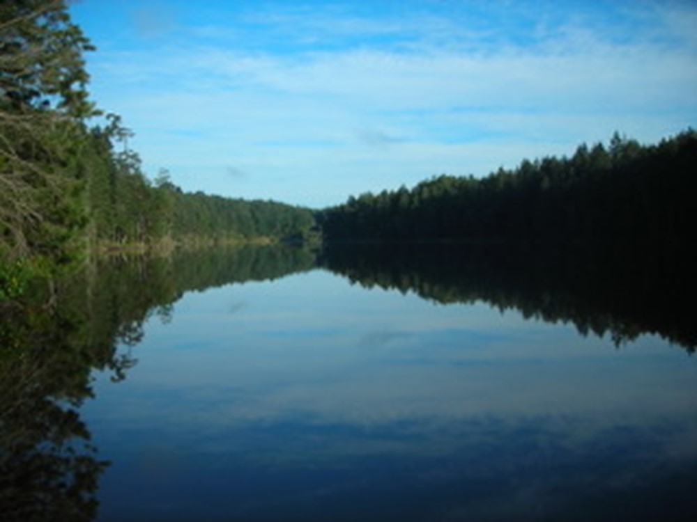
 Enos Lake is home to a wide range of aquatic and terrestrial flora and fauna, including a unique and endangered stickleback pair species. The stickleback pairs are a single species that through rapid evolution split into two separate species, drawing the attention of scientists from around the world. Their evolution is believed to be the result of rising ocean levels and inundation into the lake during two separate ice age events, each one allowing stickleback to take up residence in the lake and through different arrival times evolve separately.
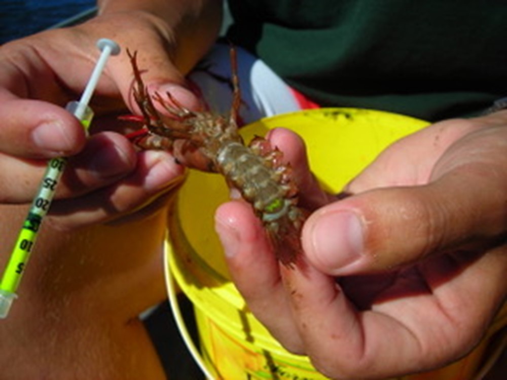 During 2006 and 2007, the Friends of Enos Lake teamed up with Vancouver Island University to study stickleback and Signal Crayfish and interactions between the two species. Of the number of non-native and invasive species in the watershed, the most pernicious are the crayfish The Friends of Enos Lake studies estimated more than 100,000 crayfish reside in the lake. Observations indicate they were introduced in the mid-1990s, and appear to have altered the ecology of the lake to the extent that the stickleback pairs have hybridized into a single species, thus losing their uniqueness. A family of river otters that frequent the lake has been observed eating the crayfish and are likely their primary predator. American Bullfrogs, another more recent invasive species known for its voracious feeding habits, may also feed on crayfish. A more peculiar invasive species revealed during the studies was a species of freshwater jellyfish endemic to Asia.
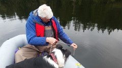 In recent years, the Friends of Enos Lake have been working in partnership with Fairwinds and the BC Conservation Foundation to monitor water quality of the lake (links to annual monitoring reports are below). Bella the Border Collie can be seen supervising collection of data by Ross Peterson in the right-hand photo. The sampling and scheduling are a requirement of the phased development agreement and an extension of the Integrated Stormwater Management Plan.