"Committed to the recovery of wild Pacific salmon in mid Vancouver
Island watersheds through habitat restoration and community engagement"
"Committed to the restoration of wild Pacific salmon in mid Vancouver
Island watersheds through habitat restoration and community engagement"

General - News

Mapping Forage Fish Spawning Sites

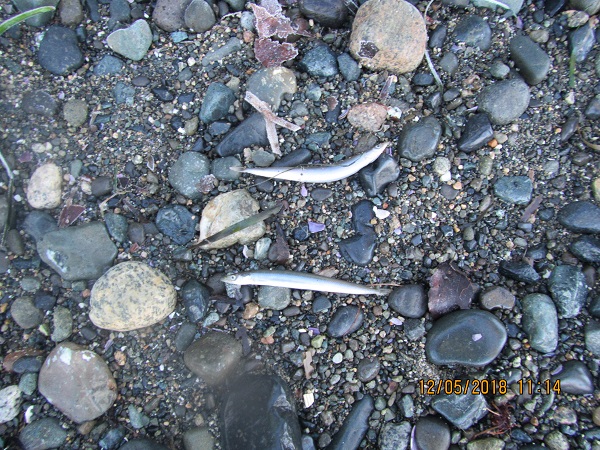
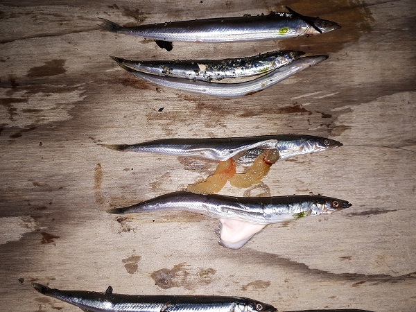
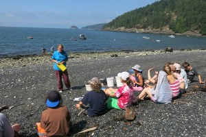
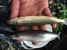
ForageFish5On June 22 and 23, volunteers assembled on a beach in San Pariel to learn how to identify and map forage fish spawning sites under the instruction of Ramona de Graaf, Independent Researcher and Co-ordinator of the Shore Spawner's Alliance. The BC Shore Spawners Alliance is an alliance of community groups working to document and protect the intertidal spawning habitat of forage fish, specifically surf smelt (top in picture) and Pacific sand lance (bottom in picture). So what are forage fish and why are they so important? 

The following is from the Islands Trust Fund website.  

"Forage fish are small fish that travel in large schools and are a food source or 'forage' for larger fish and marine mammals. Forage fish, including Pacific herring, Pacific sand lance and surf smelt form the cornerstone of marine food webs. They, and other forage fish species play an important role in the diets of Humpback  Whales, Porpoise, Sea Lions, Seals, Salmon and marine birds.

From sand grains to whales, it's all connected. Surf smelt and Pacific sand lance lay tiny eggs (1mm) on pebble and sand beaches just below the high-tide line - an area called the intertidal zone. The number and health of these beaches play an important role in the lives of the salmon, whales and marine birds that rely on each generation of forage fish for food."

Our actions on and around these beaches, like shoreline development, can impact forage fish habitat, so it is important to identify and map these areas.

ForageFish2

We first selected three 30 m stretches of fine sand and pebbles, and scooped up the top layer along each 30 m line to make a sample. The co-ordinates for the start and finish of each stretch were taken with a GPS so that they can be placed on a map. 

Then we seived and "winnowed" the sand samples to bring any eggs and embryos to the surface. This is a technique similar to panning for gold except no one has been able to retire on it. The top layer of sand, where we hoped the eggs and embryos surfaced, was collected from each pan and put in a jar.


ForageFish1

The samples were taken back to our makeshift mad-scientist laboratory where we got to play CSI. No, not really. We placed small portions of the sand samples under microscopes to search for eggs and embryos. The photo below shows what the eggs and embryos look like under the microscope.


ForageFish3


We hope to sample and map the stretch of coast line from Parksville to Qualicum Beach. Should be loads of fun and who knows, we may just find gold.


An Exciting Season of Smolt Counting Comes to an End

 Just like that song by Andrea Bocelli, it's "Time to Say Goodbye".....to the smolt trap for another year. On May 26, volunteers arrived with electric drills, trucks and a trailer to dismantle and take away the smolt trap that had been installed in Shelly Creek on March 23.

smoltfence

 dismantle1dismantle3


dismantle2

dismantle4


The past two months have been very eventful, with a mischievious otter stealing fish out of the smolt box for two days, a few lamprey eels (blech!),  and a smart phone that spent a day swimming with the fish at the bottom of the box and kept right on ticking (it even gave the owner a message that moisture was detected....smart). And we had a visit by a reporter from the PQB News. You can view the newspaper article and video here.

This year's Coho smolt count was the best in 5 years. We counted 6963 Coho smolts and fry, and with the approximately 400 that the otter ate, we estimate there were 7363 smolts and fry in the migration out of Shelly Creek into the Englishman River, with the smolts continuing on to the ocean. We also counted the most trout ever for the smolt trap: 296 of which 51 were identified as Cutthroat.

How does this compare to other years?          

YEAR

NUMBER OF SMOLTS

NUMBER OF TROUT

2011

2638

37

2012

8094

42

2013

7265

21

2015

1247

0

2016

4313

60

2017

755

153

2018

7363

296

2017 had very low smolt numbers because an  extremely wet spring caused the creek level to rise high enough to bypass the trap. Depsite the bypass, we still captured the most trout  since the smolt trap count was initiated in 2011. We think the reason for the increase in trout in 2017 and 2018 may be due to the removal of yellow iris (an invasive species) which had taken up a great deal of habitat space in Martindale Pond. With the iris gone, the amount of open water habitat has increased significantly.

Many thanks to our volunteers for making 2018 the best year yet for the smolt trap count!                                                        

Holy smolts, that's a lot of fish!

Wow, 890 Coho smolts in one day! That was the catch one day last week at the smolt trap on Shelly Creek. We're still getting 100 to nearly 300 a day so don't miss out on the action. The migration out of the creek into the Englishman River will probably run for another 3 weeks, so there's still time to participate and help collect important data on the importance of Shelly Creek as a overwintering habitat for salmon smolts. We start at 9 am everyday at the trap on Martindale Rd. Sign up for the days you are available right here: Sign Up.

Don't forget your wellies or chestwaders! 


smoltfencesmallsmoltvolunteerssmolttrap2017